May 2025
April 2025
March 2025
- Screenshot 2025 03 20 151559
- Screenshot 2025 03 20 151524
- Screenshot 2025 03 20 151451
- Screenshot 2025 03 14 121846
- Screenshot 2025 03 14 121819
- Screenshot 2025 03 14 121746
February 2025
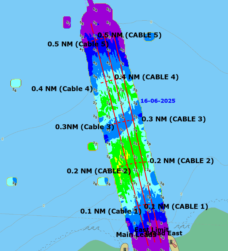
The most important requirement for crossing the bar and entering the Westport Harbour is to obtain qualified advice first, from either the Harbour Master or the port information line.
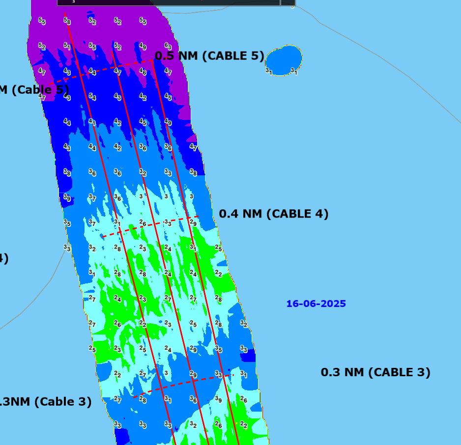
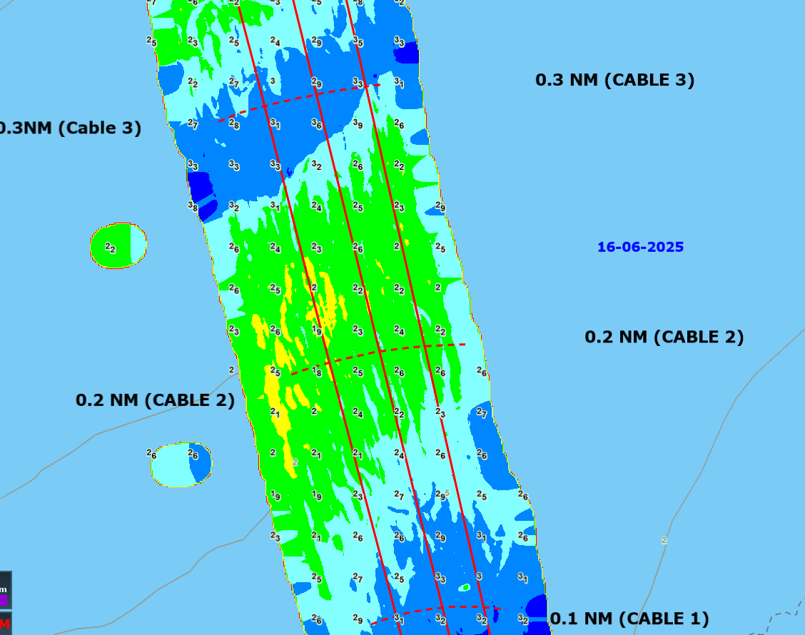
The bar is generally sounded after significant weather events or as required. The most recent bar information will also be published on this page, be published as a safety notice, posted on the noticeboard at Talley’s or can be emailed to you.
Please note the date of each sounding. As conditions may change daily, particularly the bar, lagoon entrance and river berths, there is no certainty that the depths shown remain current. Sounding accuracy can vary plus or minus 0.1 metres and Council does not give any warranty as to the accuracy of these soundings.


View the previous bar soundings to see how the bar has changed over time. This page only displays bar sounding from the previous three months.
May 2025
April 2025
March 2025
February 2025
Port entry or departure should not be made when waves are breaking on the bar or entrance. Please obtain detailed weather and bar sounding information before crossing.
• Prior to approaching the bar an "ALL SHIPS CALL" must be made.
• Only one vessel at a time can cross the bar.
• When leaving the lagoon an "ALL SHIPS CALL" must be made.
For more information on communication, read about how to radio in.
Bar conditions are a function of:
Any one, or a combination of the above could make crossing the Bar dangerous. If in doubt, stay out!
The run in the river peaks 12-18 hours after heavy rain in the mountains and can reach 8-10 knots even though the river may not appear to be in flood. The danger is not being able to make headway against the run, especially at the entrance. Very steep and short (close together) breaking waves can develop as the run holds up the incoming swells.
With heavy north-westerly swells or strong south-west/west winds, the current across the Bar entrance can reach 5 knots, with the danger of being pushed into breaking shallows to the east very quickly. Counteracting a strong set may mean presenting your beam to the swell with subsequent danger of broaching. Generally, we describe the set as easterly or westerly, slight, moderate, strong or very strong. If it is very strong (4 to 6 knots), crossing is ill-advised.
Sometimes you can have different sets, e.g. a westerly set at 5 cables and then an easterly set close in, check out the Easterly Set Diagram.
Westport Harbour entrance faces north. Generally, a north-westerly swell will affect the Bar the most, although a heavy south-westerly swell is quite capable of refracting around Cape Foulwind and breaking on the Bar.
Swells of 4 metres are not uncommon. Sometimes a long, low swell, barely noticeable off the coast, can produce a nasty breaking wave at the outer shoals. Always watch out behind you as you cross, a crew member can look out and warn of a building swell.
The available depth of water is important. Set and breaking swells are considerably reduced at the top of the tide, it is especially noticeable as the tide reaches 3 metres above chart datum on the day. It can be worthwhile waiting for that situation.
If your draft is 3.0 metres or more, you require a pilot (see Maritime Rule 90, Pilotage). Advice from the Harbour Master on Bar conditions, depth of water and the recommended route across the Bar, is available by calling phone (03) 788 8086 (24hrs).
It is mandatory for all vessels to change to Channel 14 VHF at 1 mile from the breakwater entrance until berthed or vice versa.
Definitions of leading lines, which are used to describe safe routes:
Advice on these leads can be obtained by contacting the Harbour Master.
Disclaimer: While the Buller District Council has exercised all reasonable care and skill in carrying out and analysing soundings, it accepts no liability in contract, tort or otherwise howsoever, for any loss, damage, injury or expense (whether direct, indirect or consequential) arising out of the provision of this information to any person or organisations.